
|
|
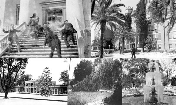
Images of snow and freeze events in Florida. Courtesy of Florida Memory.
Although many people head south to escape the cold in the winter, it isn't always warmer in Florida. When an intense low pressure system is followed by a strong high pressure system, particularly powerful invasions of cold air may occur in Florida. These cold air outbreaks can produce below-freezing temperatures and are usually accompanied by strong winds that can produce bitterly cold wind chills.
Over the past 150 years, numerous severe cold outbreaks have affected Florida. In February 1899, a cold wave that became known as the Great Arctic Outbreak pushed frigid Canadian arctic air into the state. During this event, the lowest temperature ever recorded in Florida (-2°F) occurred on February 13, 1899. Since this outbreak, a number of "impact freezes" have influenced the retreat of the famous Florida orange groves from areas around Jacksonville and St. Augustine to their current locations in south Florida.
| SIGNIFICANT FLORIDA IMPACT FREEZES | |||
| Freeze Event | Tallahassee | Avon Park | Fort Myers |
| December 1894 | 15°F | 24°F | 28°F |
| February 1899 | -2°F | N/A | N/A |
| December 1934 | 20°F | 21°F | 29°F |
| January 1940 | 15°F | 26°F | 29°F |
| February 1958 | 19°F | 23°F | 30°F |
| December 1962 | 20°F | 24°F | 28°F |
| January 1977 | 16°F | 21°F | 30°F |
| January 1981 | 8°F | 18°F | 28°F |
| January 1982 | 14°F | 19°F | 29°F |
| December 1983 | 14°F | 23°F | 33°F |
| January 1985 | 6°F | 21°F | 30°F |
| December 1989 | 13°F | 20°F | 27°F |
| January 1997 | 18°F | 24°F | N/A |
Contrary to popular belief, it does snow in Florida. The first documented account of snow in Florida was reported in 1774. During the Great Arctic Outbreak, which was responsible for one of the biggest widespread snow events in the state, snow measured up to 3 inches deep in numerous Panhandle communities, and snow flurries were reported as far south as Fort Myers. Since 1886, there have been more than 80 months in which at least a trace of snow has been reported somewhere in the state.
| EXAMPLES OF FLORIDA SNOW EVENTS SINCE 1950 | |
| Date | Description |
| February 2, 1951 | Two inches were reported in St. Augustine and Crescent City. |
| March 6, 1954 | Four inches were reported at the Milton Experimental Station; this total holds as the 24-hour state snowfall record. |
| February 13, 1958 | Rain changed to snow; 1.5 inches were reported in Jacksonville, and 2.8 inches reported in Tallahassee. |
| February 9-10, 1973 | A large snowstorm that affected the Southeast U.S. brought 1.8 inches of snow in Pensacola on the 9th and 0.4 inches in Tallahassee on the 10th. Flurries were reported as far south as Lisbon and Clermont. |
| January 17-19, 1977 | Snow started falling in Pensacola on the 17th. On the 19th, flurries were reported as far south as Homestead. Areas along I-4 (Tampa/Orlando) reported 1 to 2 inches of snow. |
| December 23, 1989 | Rain changed to snow in Jacksonville, and totals of several inches were reported in some locations; the city had its first White Christmas. |
| March 12, 1993 | The '93 Superstorm produced up to 4 inches of snow along the Florida Panhandle. |
| November 21, 2006 | A dusting of snow fell over portions of central Florida, the first November snow in the state since 1912. |
| January 8-9, 2010 | A light dusting of snow was seen in Jacksonville. Light snow fell in parts of central Florida with sleet/snow reported in Orlando, Tampa, and Melbourne. Flurries are reported in West Palm Beach and Kendall. |
| December 26, 2010 | A mix of snow and sleet was reported in Jacksonville, with a freezing fog event around midnight. Tallahassee, Gainesville, and other locations in the northern peninsula reported flurries during the day. |
| January 21-22, 2025 | A historic winter storm affected the U.S. Gulf Coast, stretching from Texas to the Florida Panhandle. The highest snowfall amounts reported in Florida were up to 10 inches measured in Escambia County and near Jay in northern Santa Rosa County. Pensacola recorded 8.9 inches of snow at the airport. Further east, a sharp gradient of snow to a wintry mix of sleet and snow formed. Marianna reported 5 inches of snow, and 3.5 inches was reported near Panama City. Tallahassee recorded 1.9 inches of snow, beginning with mostly sleet on the night of January 21 and turning over to snow on the morning of January 22. Trace amounts of snow were reported in Northeast Florida. |