March 17th, 2016
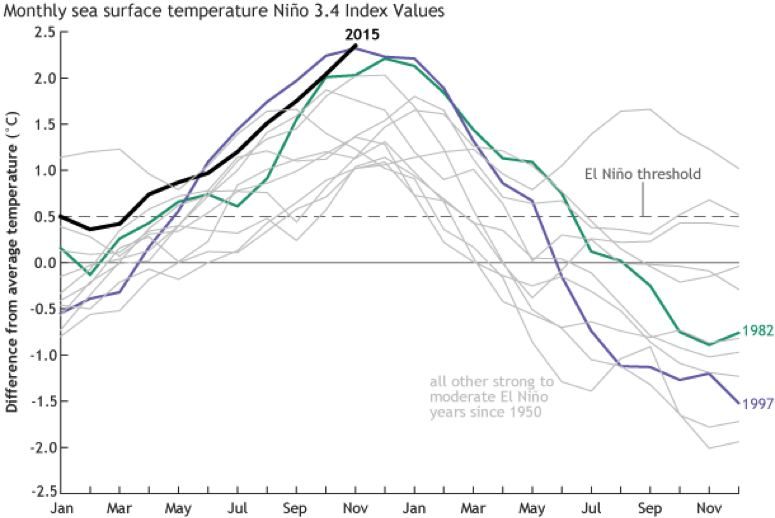
In short, this El Niño reached its peak back in November and by some measures of sea surface temperature was even stronger that 97/98. It has begun a steady decline since then, as most all moderate and strong El Niño's do in the spring. That being said, it is still fairly robust and will bring stormy and rainy weather for the next month or so.

Current El Niño compared to other moderate and strong events since 1950.
Courtesy NOAA
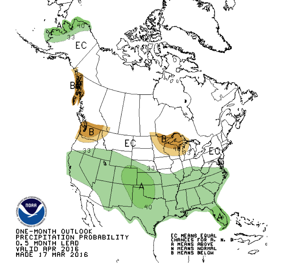
Once we hit mid-April, the Pacific Ocean really loses its hold on our weather and climate patters in the Southeast, regardless of the phase. So spring should be more normal, and by normal we mean that the full range of variability is in play, but no preference for wet or dry. If there is any leaning, the early summer following El Niño may be a little drier than normal, but there is not a lot of confidence or consistency there.

One-month outlook for April 2016.
Courtesy NOAA
For the tri-state area, we are past the median date of last freeze. The extended outlooks do not indicate any risk of unseasonably cold weather, so there is a good chance we have already seen the last freeze.
The majority of moderate and strong El Niño's were followed by a transition to La Niña the following summer and fall. The others are mostly followed by neutral, only rarely does El Niño return for second year. NOAA and IRI just updated their forecast and they call for a 50% chance of La Niña by fall, 35% chance of neutral, and 15% El Niño. La Niña would trend toward warm and dry in the late summer, and even more so in the fall and winter.
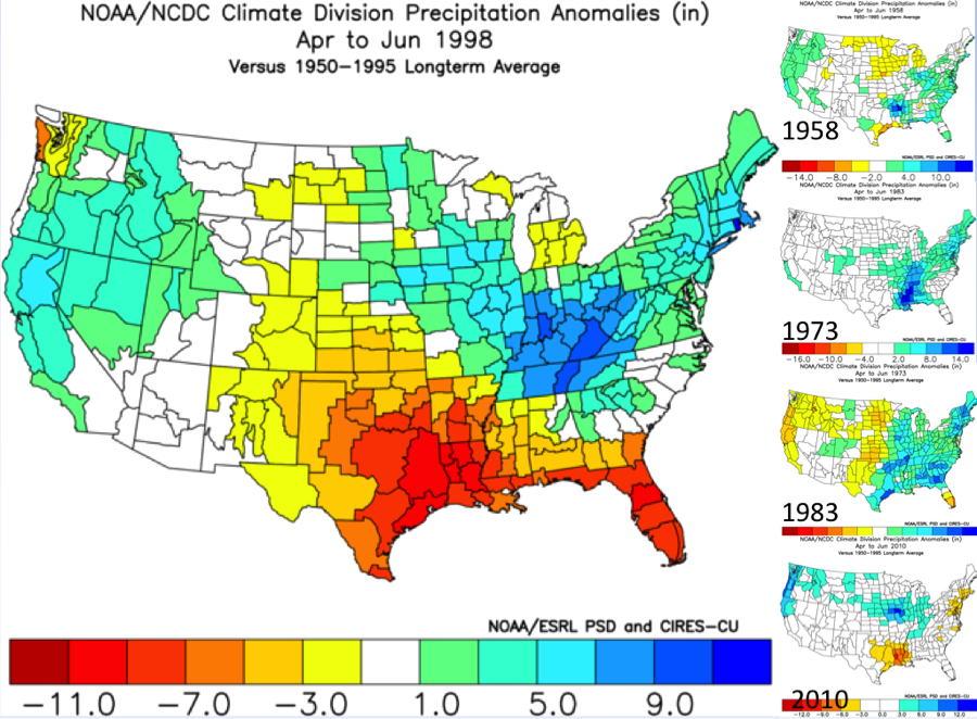
Here in Florida there was a lot of worry about spring drought, like the severe drought and record dryness in 1998. 1998 also had a very rapid transition to La Niña in May of that year. However, there is no historical analog to 1998 even in similar transitions from strong El Niño to La Niña. With that in mind, we have to be aware of the possibility of spring drought though it is low probability. It already appears that any possible transition to La Niña will not be as rapid as 1998.

Spring (Apr. - June) precipitation anomalies in 1998 compared to similar strong El Nino’s. 1958 and 1973 had a spring/summer transition to La Nina, 1983 and 2010 transitioned to neutral.

