From AgroClimate.
Date updated: November 13, 2009
El Niño reaches moderate strength and continues to build in the Pacific Ocean.
 |
 |
|
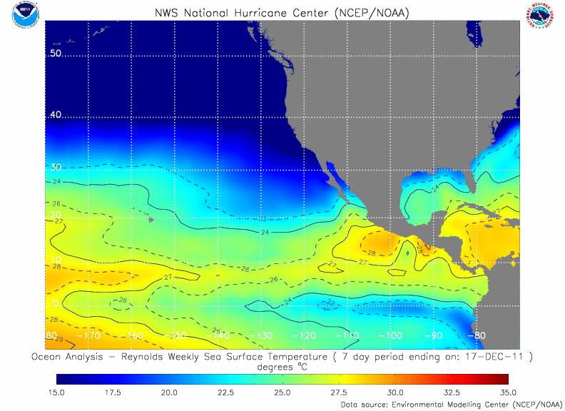
Current East Pacific SST Analysis |
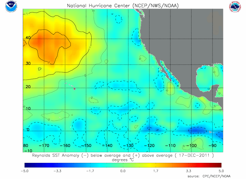
Current East Pacific SST Anomaly Analysis |
| Click on each image for a full-size version. | |
Ocean temperatures in the past few months have continued to warm in the eastern and central tropical Pacific Ocean and are now over 1.0 degree C warmer than normal over a large area. Sea surface temperatures in this region of 0.5 degree C warmer than normal are the commonly used threshold to designate El Niño conditions. El Niño refers to a periodic (every 2-7 years) warming of the tropical Pacific Ocean along the equator from the coast of South America to the central Pacific. Once surface temperatures warm to over 1.0 degrees C the El Niño is considered moderate in strength (the three classifications are weak, moderate, and strong). This warming began in May and has continued through the summer and fall months. The development of this El Niño follows the typical life cycle of building in the summer and fall months before reaching peak strength in mid winter.
Weakened trade winds over the central Pacific and abundant warm water beneath the surface indicate that surface temperatures will continue to warm in the next 1 to 3 months. Modeling centers around the world that predict El Niño/La Niña agree that waters will continue to warm and result in at least a moderate El Niño during the winter and spring months. There is a small chance that the El Niño will reach the strong category. There is no chance of La Niña returning in the near future and very little chance of neutral conditions.
The development of El Niño could have dramatic impacts on the climate of the Southeast for the remainder of 2009. First, El Niño hinders hurricane development in the Atlantic basin and is largely responsible for the relatively quiet season thus far. El Niño has its strongest impacts on the Southeast in the colder months, bringing wet, stormy, and cool winter and spring seasons to the Southeast. For more detailed information on climate impacts in the Southeast, see the latest climate outlook.
The SECC tracks the temperatures of the Pacific Ocean using the JMA index. For more information and current JMA values, see the following link:
Other El Niño/La Niña Forecasts
Below are links to El Niño/La Niña forecasts from other centers in the U.S. and worldwide. Caution: the SECC may not agree with their forecasts and/or classification criteria.